


How UAS/Drones Are Used In Inspections & Insurance

UAS/Drone Use in Inspections & Insurance
Ace of Drones | Oklahoma City

Drones have become powerful tools for inspection professionals, insurance carriers, adjusters, engineers, property owners, and asset managers. Inspections that once required ladders, scaffolding, lifts, rope access, or personnel working in hazardous locations can often be performed more efficiently from the air.
At Ace of Drones, we provide professional aerial inspection data designed to improve safety, accelerate field documentation, strengthen claim evidence, and give decision-makers a clear visual record of property and asset conditions.
This page explains how drones are used throughout the Inspection and Insurance industries, the data they can collect, and the operational and financial benefits they provide.

How Drones Are Used in Inspections & Insurance
Inspection professionals and insurance organizations use drones for:
Roof inspections and condition assessments
Storm and catastrophe damage documentation
Hail and wind damage documentation
Building-envelope inspections
Commercial property inspections
Residential property inspections
Pre-loss property documentation
Post-loss claim documentation
Thermal inspections
Moisture and water-intrusion investigations
Solar panel and solar-farm inspections
Utility and infrastructure inspections
Tower, antenna, and elevated-structure inspections
Façade and exterior wall inspections
Construction-defect documentation
Large-property and site assessments
Georeferenced mapping and orthomosaic creation
3D modeling and Digital Twins
Measurement and dimensional analysis
Historical condition monitoring and change detection
High-resolution RGB imagery, thermal imagery, georeferenced orthomosaics, point clouds, and textured 3D models can provide inspectors, adjusters, engineers, carriers, property owners, and contractors with detailed information without requiring physical access to every portion of the asset.
Core Benefits of Drones in Inspections & Insurance

Faster Inspection and Documentation
Drones can document large roofs, commercial buildings, industrial facilities, towers, solar installations, and other difficult-to-access assets much faster than many conventional inspection methods.
A planned flight can collect hundreds or thousands of photographs while maintaining systematic coverage of the inspection area.
For insurance operations, faster data acquisition can help shorten the time between a reported loss and the availability of detailed visual evidence for review.
Reduced Exposure to Inspection Hazards
Traditional inspections may require personnel to climb ladders, walk damaged roofs, operate aerial lifts, erect scaffolding, or work near unstable structures.
Drone inspections can reduce the amount of time personnel must spend:
At height
On steep or damaged roofs
Near unstable structures
Around electrical infrastructure
Near damaged buildings
In difficult terrain
Around industrial hazards
In areas affected by storms or disasters
Drones do not eliminate every inspection hazard or the need for qualified inspectors, but they can substantially reduce unnecessary physical exposure during initial assessment and documentation.
Better Visual Documentation
A properly planned drone inspection creates a systematic visual record rather than relying only on isolated photographs captured from accessible locations.
High-resolution imagery can document:
Roof surfaces
Flashing
Penetrations
Drainage systems
HVAC equipment
Parapets
Exterior walls
Windows
Gutters
Mechanical equipment
Structural components
Storm-related damage
Adjacent property conditions
Images can be organized by location and incorporated into inspection reports, claim files, engineering assessments, maintenance records, or property-management systems.
Stronger Insurance Claim Documentation
Insurance decisions depend heavily on reliable documentation.
Drone imagery can provide objective, date-stamped visual evidence of property conditions following hail, wind, tornadoes, severe thunderstorms, fire, flooding, and other loss events.
Aerial documentation can assist with:
Initial loss assessment
Claim documentation
Damage-location identification
Adjuster review
Engineering review
Contractor estimates
Scope verification
Supplemental claim documentation
Repair verification
Dispute documentation
The drone is a data-collection platform. Coverage determinations, causation opinions, engineering conclusions, and claim decisions remain the responsibility of appropriately qualified professionals.
More Complete Property Coverage
Ground inspections are inherently limited by accessibility and viewing angle.
A drone can provide overhead, oblique, close-range, and wide-area perspectives of the same property.
This allows reviewers to understand not only individual defects but also their relationship to the overall structure.
For large commercial losses, this broader perspective can be particularly valuable when multiple roof sections, elevations, mechanical systems, drainage features, or structures must be evaluated.
Key Deliverables and Applications
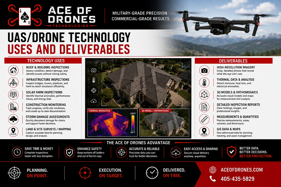
UAS/DRONE TECHNOLOGY USES AND DELIVERABLES
High-Resolution Roof Imagery
Detailed RGB photographs can document shingles, membranes, metal roofing, flashing, penetrations, vents, drainage components, rooftop equipment, and visible damage.
Images can be captured systematically so specific roof sections and observed conditions can be identified within the final report.
Orthomosaic Imagery
Multiple overlapping photographs can be processed into a high-resolution, georeferenced orthomosaic.
Unlike a conventional aerial photograph, an orthomosaic can provide a consistent overhead representation suitable for viewing, annotation, mapping, and—when collected and processed appropriately—measurement.
For large commercial properties, an orthomosaic can serve as a visual index for inspection findings.
Thermal Imaging
Thermal sensors measure differences in emitted infrared radiation and can reveal temperature patterns that may warrant additional investigation.
Depending on the asset, environmental conditions, and inspection methodology, thermal imaging may assist in identifying patterns associated with:
Potential moisture intrusion
Insulation anomalies
Building-envelope irregularities
Electrical hot spots
HVAC performance issues
Solar-module anomalies
Thermal imagery must be interpreted carefully. A thermal anomaly does not automatically identify the underlying cause, and suspected conditions may require confirmation using additional inspection methods.
3D Modeling & Digital Twins
Photogrammetry can transform overlapping aerial imagery into detailed 3D representations of buildings, roofs, structures, and surrounding property.
These models can support:
Remote inspection review
Dimensional analysis
Damage-location documentation
Repair planning
Engineering review
Property records
Before-and-after comparisons
Long-term asset management
Repeated inspections can create a historical digital record showing how an asset changes over time.
Pre-Loss Property Documentation
Drone inspections can establish a visual baseline before a loss occurs.
Baseline documentation can include:
Roof condition
Exterior elevations
Site conditions
Drainage features
Rooftop equipment
Adjacent structures
Existing visible deficiencies
When a later claim occurs, historical imagery may help qualified professionals compare pre-loss and post-loss conditions.
Post-Loss Damage Documentation
Following a storm or other loss event, drones can rapidly document affected areas.
Systematic imagery can help identify where visible damage is located and provide evidence for adjusters, engineers, contractors, carriers, and property owners to review.
Hail & Wind Damage Documentation
Drone imagery can assist qualified inspectors in documenting visible conditions potentially associated with severe weather, including displaced or missing roofing materials, damaged flashing, exposed substrates, displaced components, debris impacts, and other observable conditions.
Final determinations regarding damage mechanism, causation, repairability, and insurance coverage should be made by the appropriate qualified professional.
Building Envelope Inspections
Drones can inspect exterior building components that may otherwise require scaffolding, lifts, or rope access.
Common inspection targets include:
Façades
Masonry
Curtain walls
Windows
Sealants
Parapets
Roof-to-wall transitions
Exterior cladding
Expansion joints
Drainage features
Commercial Roof Inspections
Large commercial roofs can require extensive field time to inspect manually.
Drone-based capture can provide comprehensive documentation of membranes, penetrations, drains, rooftop equipment, flashing, seams, ponding areas, and visible surface conditions.
Solar Inspection
RGB and thermal sensors can be used together to inspect rooftop and utility-scale photovoltaic systems.
Depending on methodology and conditions, thermal data can assist qualified personnel in identifying patterns associated with:
Module hot spots
String-level anomalies
Bypass-diode issues
Soiling
Shading
Vegetation encroachment
Tracker misalignment
Potential electrical abnormalities
RGB imagery provides visual context for thermal findings and supports subsequent verification.
Infrastructure and Elevated Asset Inspections
Drones can inspect assets that are difficult, expensive, or hazardous to access manually, including:
Towers
Antennas
Bridges
Tanks
Silos
Utility structures
Industrial facilities
Elevated mechanical equipment
High-resolution imagery allows specialists to review components from the ground or office while reducing unnecessary work at height.
Ace of Drones Technical Capabilities
Flight Stability and GNSS Accuracy

Professional inspection platforms can incorporate:
Multi-band GNSS support
GPS, GLONASS, and Galileo positioning
Real-Time Kinematic (RTK) positioning
Post-Processed Kinematic (PPK) workflows
Precise georeferencing for mapping applications
Accurate positioning becomes particularly important when inspection findings must be mapped, measured, revisited, or compared with future inspections.
High-Resolution RGB Sensors

High-resolution RGB cameras provide detailed visual documentation for roof, façade, infrastructure, property, and insurance inspections.
Proper flight planning, overlap, viewing angles, distance, exposure settings, and image organization are essential to creating useful inspection datasets.
Thermal Sensor Capability

Radiometric thermal sensors can add another layer of information by recording temperature-related data across an inspected surface.
Effective thermal inspection requires consideration of environmental variables such as:
Solar loading
Ambient temperature
Wind
Cloud cover
Surface materials
Emissivity
Reflections
Inspection timing
Temperature differentials
Ace of Drones plans thermal missions around the requirements of the specific inspection rather than treating thermal imagery as a simple visual photograph.
Gimbal Stabilization and Controlled Image Capture
Stabilized camera systems allow detailed imagery to be collected from multiple angles while maintaining image clarity.
This is particularly valuable when inspecting roof edges, façades, towers, mechanical equipment, penetrations, and vertical structures.
Insurance Applications Across the Property Lifecycle
Drone technology can support insurance operations before, during, and after a loss.

Pre-Loss Risk Documentation
Before a claim occurs, aerial inspections can document property condition and identify observable characteristics relevant to risk assessment and asset management.
A baseline aerial record may help establish the documented condition of a property at a specific point in time.
Post-Loss Assessment
Following a loss, drones can rapidly collect visual evidence while reducing the need for personnel to immediately enter potentially hazardous areas.
This is particularly valuable following severe weather when damaged roofs, fallen trees, debris, compromised structures, or restricted access may make conventional inspection difficult.
Claims Investigation Support
Drone imagery can be provided to adjusters, engineers, contractors, consultants, and other authorized professionals for review.
Rather than relying solely on field notes and a limited number of photographs, stakeholders can review a more complete visual record of the property.
Repair and Restoration Verification
After repairs are completed, a follow-up drone inspection can document completed work and provide before-and-after evidence.
This creates a traceable visual record from initial damage through restoration.
Catastrophe Response
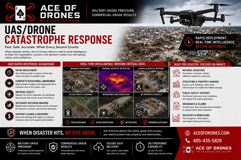
Large hailstorms, tornadoes, hurricanes, wind events, flooding, and other catastrophes can generate hundreds or thousands of claims within a concentrated geographic area.
Drone operations can help catastrophe-response teams collect aerial information across affected properties while limiting unnecessary exposure to damaged structures.
Depending on airspace restrictions, site conditions, weather, and regulatory requirements, drone teams can support:
Initial property documentation
Large-area visual assessment
Roof-condition documentation
Commercial property assessment
Damage mapping
Georeferenced imagery
Adjuster support
Engineering documentation
Repair-progress monitoring
The value is not simply flying faster. It is creating organized, repeatable, reviewable data that can move efficiently through the claims process.
Inspection Data Organization and Reporting
Capturing images is only the beginning of a professional drone inspection.
Inspection data should be organized so the client can understand:
What was inspected?
Where was the condition observed?
What evidence supports the observation?
How severe or significant is the observation?
What additional review may be appropriate?

Depending on the project, an Ace of Drones inspection package can incorporate:
Executive summary
Flight information
Property or asset information
Inspection methodology
Environmental conditions
Annotated RGB imagery
Thermal imagery
Finding identification numbers
Finding locations
Severity or priority classifications when appropriate
Coordinates
Roof-section or asset identifiers
Orthomosaic maps
3D models
Supporting image galleries
Recommended follow-up actions
Data appendices
Structured reporting transforms drone imagery from a collection of photographs into actionable inspection intelligence.
Repeatable Inspection Workflows
One of the strongest advantages of drone-based inspections is repeatability.
Once an inspection area and methodology have been established, future flights can capture similar perspectives and coverage.
Repeated datasets can support:
Annual roof inspections
Preventive maintenance
Warranty documentation
Storm-event comparisons
Asset-condition monitoring
Repair verification
Before-and-after analysis
Long-term deterioration tracking
Over time, the organization develops a visual history of the asset rather than relying solely on individual inspection reports.
Data Ownership, Security & Chain of Custody
Inspection and insurance data may become part of a claim file, engineering investigation, legal proceeding, maintenance record, or corporate asset-management system.

For that reason, data management matters.
Project requirements can define:
File naming conventions
Original-image retention
Processed-data retention
Access permissions
Storage requirements
Geospatial metadata
Image timestamps
Delivery formats
Chain-of-custody procedures
Client confidentiality requirements
Clear data governance helps preserve the integrity and usefulness of inspection evidence.
Airspace Authorization, Compliance & Operations
Inspection locations may be located near airports, hospitals, military facilities, urban infrastructure, or controlled airspace.
Ace of Drones plans operations around applicable FAA requirements and site-specific restrictions.
Operational planning can include:
Airspace review
Required FAA authorization
Aircraft registration and identification requirements
Flight-area assessment
Altitude restrictions
Visual line-of-sight requirements
Site access
Weather evaluation
Takeoff and landing areas
Personnel and public safety
Emergency procedures
Early airspace and site review helps prevent unnecessary delays once an inspection is scheduled.
Pilot Certification and Internal Protocols
Commercial drone operations are conducted by appropriately certificated remote pilots in accordance with applicable FAA requirements.
Professional inspection operations should incorporate:
Pre-flight planning
Aircraft inspections
Mission-specific checklists
Weather evaluation
Airspace verification
Site hazard assessment
Battery management
Emergency procedures
Post-flight documentation
Data-quality verification
For inspection work, successful operations depend not only on the aircraft but on disciplined mission planning and consistent data collection.
Integrating Drone Data into Insurance & Inspection Workflows
Drone data provides the greatest value when it integrates directly into the systems professionals already use.
Images, maps, models, and inspection findings can support:
Claims-management systems
Property-management platforms
Asset-management systems
GIS platforms
Engineering workflows
Inspection-reporting software
Maintenance databases
Estimating workflows
Digital Twin environments
The objective is not to create another isolated dataset. It is to provide inspection information in formats that support the client's existing decision-making process.
Benefits for Insurance Carriers, Adjusters & Inspection Professionals
More Consistent Documentation
Standardized flight plans and reporting procedures can improve consistency between properties, inspections, and operators.
Faster Access to Evidence
Digital inspection data can be reviewed remotely by authorized stakeholders without requiring every specialist to physically visit the property.
Improved Collaboration
Adjusters, engineers, contractors, property owners, and other professionals can reference the same visual evidence when discussing observed conditions.
Reduced Inspection Exposure
Drones can reduce the amount of time personnel spend on roofs, ladders, lifts, towers, and other elevated or hazardous locations.
Better Historical Records
Repeat inspections create date-stamped records that can be compared across months or years.
Scalable Inspection Programs
Organizations responsible for multiple properties can establish repeatable inspection standards across an entire portfolio.
Why Partner with Ace of Drones
Oklahoma City-based Drone Service Provider
Professional UAS inspection and data-collection capabilities
High-resolution RGB and thermal imaging
RTK/PPK-capable mapping workflows
Georeferenced imagery and mapping
Photogrammetry and 3D modeling
FAA Part 107 commercial operations
Airspace planning and authorization management
Safety-focused flight procedures
Structured, actionable inspection deliverables
Flexible service model without the expense of maintaining an internal drone department
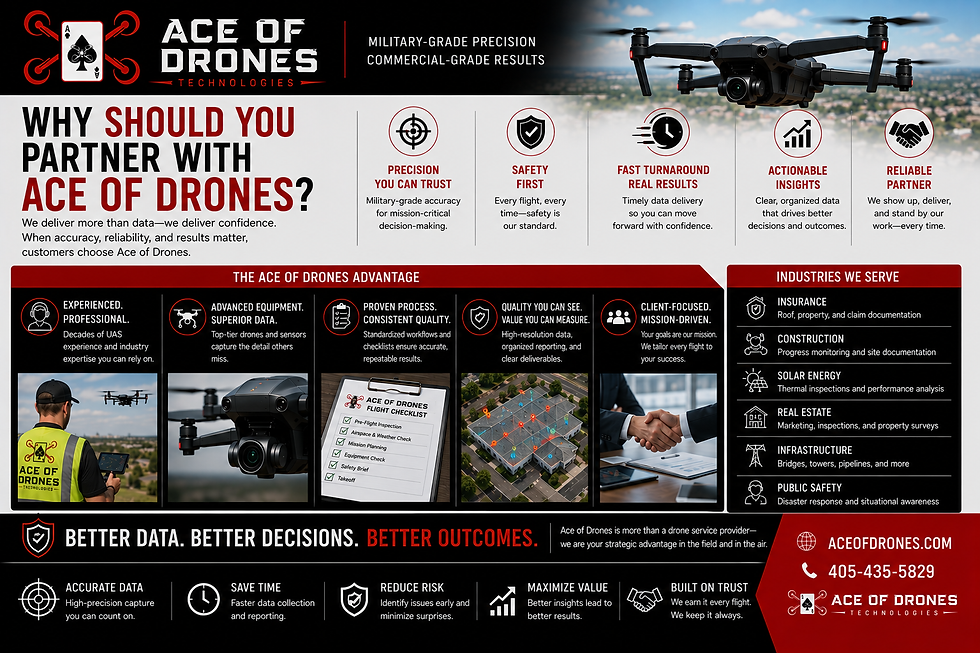
Drones give inspection and insurance professionals faster access to visual intelligence, broader asset coverage, reduced exposure to hazardous conditions, stronger documentation, and a repeatable digital record of property conditions.
Ace of Drones turns aerial imagery into organized inspection data that professionals can actually use.
Whether the objective is documenting a residential roof after a hailstorm, inspecting a large commercial building, evaluating a solar installation, establishing pre-loss property conditions, supporting an insurance claim, or creating a long-term asset record, every mission begins with the same objective: collect the right data, safely, accurately, and consistently.
Ready to improve the way your organization collects inspection data?
Contact Ace of Drones to discuss roof inspections, insurance claim documentation, thermal inspections, catastrophe-response support, commercial property inspections, infrastructure inspections, mapping, 3D modeling, or custom UAS inspection programs.
1


Comments